
On Car Free Day, Westminster’s Labour administration unveiled Clean Air Routes London, a free interactive map that helps residents, workers, and visitors choose walking and cycling routes with lower exposure to harmful air pollution. It’s another concrete step in our mission to cut toxic air and put public health first.
Air pollution steals years from Londoners’ lives and hits children, older people and those with heart and lung conditions the hardest. That’s why Westminster Labour is doing what previous administrations wouldn’t – taking practical, people-first action to reduce exposure now while we continue cutting emissions at source.
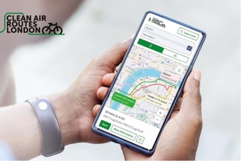
That’s why we launched Clean Air Routes London, a free, easy-to-use tool that suggests up to three route options between any two points and recommends the path with the lowest pollution exposure, drawing on live and forecast air quality data — including readings from Westminster’s own sensor network. Developed with Cambridge Environmental Research Consultants (CERC) and supported by DEFRA, it helps families walking to school, commuters on bikes and visitors exploring our city to breathe easier with every journey.
This sits alongside our wider programme: from our Air Quality Action Plan 2025–2030 and a bigger Labour plan to prioritise health, fairness and climate responsibility over the status quo, including:
- Expanding active travel and safer cycle routes.
- Backing zero-emission deliveries and micro-logistics hubs to cut van traffic and pollution.
- Rolling out emissions-based parking charges and one of the UK’s largest EV charging networks.
- Supporting local businesses and institutions to decarbonise through the Sustainable City Charter and Westminster Climate Fund.
Councillor Geoff Barraclough, Cabinet Member for Planning and Economic Development, said
“Clean air is a basic right, not a privilege. Clean Air Routes London helps parents choose healthier school runs and gives everyone safer ways to get around. We’re backing walking and cycling and investing in cleaner freight.”